Showing posts with label Cape Spear NL. Show all posts

Wednesday, July 19, 2023

Sparky's Epic Adventure Across North America (Cape Spear, on the edge of Canada)

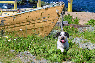
Sparky at Cape Spear, NL
 July 18th: Cape Spear, the eastern edge of Canada, is located just a short drive from St. John's, Newfoundland. Sparky and I visited there, and he posed for a photo! 


Cape Spear, Newfoundland, photo Kevin Williams

Cape Spear looking toward St. John's harbour


Marker for the East Coast Trail
And for my hiking and trekking friends. The East Coast Trail is a wilderness pathway that passes through more than 30 communities in Newfoundland, for a distance of 336 kilometres, or 209 miles. National Geographic named it one of the best adventure destinations in 2012. 


Old-time police car in Black Head, Newfoundland

Then we roamed around the St. John's harbour entrance that was once protected by the now defunct Fort Amherst.

Entrance to St. John's harbour

Houses on the Signal Hill side of the harbour


After dinner, I took the Fuzz-butt for an evening stroll along the summertime-only pedestrian mall located just two blocks from our hotel. The restaurants on Water Street were busy, but I was in bed and asleep far too early to hear the live music playing in various venues on nearby George Street. 

Water Street St John's, NL 

We had an early morning departure because we were travelling from St. John's to the southern tip of the Burin Peninsula, a six-hour drive. 

Cheers, Lynda and Sir Fuzz-butt


Sunday, July 16, 2023

Sparky's Epic Adventure Across North America (Pouch Cove, at the eastern edge of Canada)

July 16th: from my viewpoint at Pouch Cove, at the tip of the Avalon Peninsula near St. John's, Newfoundland, it appeared that Sparky and I had reached the end of Canada. 

Just open ocean between here and Europe
However, Cape Speara headland located a little south of St. John's at a longitude of 52°37' W, is the easternmost point in Canada and North America, excluding Greenland. 

We were close at a longitude of 52°77' and all I could see was the open ocean. The next piece of land would be England? Or France?


The boat ramp in Pouch Cove, NL
Established in 1611, Pouch Cove is a tiny, roundish, steep-sided cove shaped like a pouch. The locals store their personal boats on a ridiculously steep incline. I had vertigo just standing at the top of the ramp, trying to take a photograph.

We are staying in the capital city of St. John's for three days at a hotel in the harbour and within walking distance of the famous "Jelly Bean Row". I am looking forward to roaming the streets and photographing the dozens of colourful row houses.

Cheers, Lynda and The Sparkinator 

Boat ramp at Pouch Cove, NL

Looking down the boat ramp


The Sparkinator at Pouch Cove, NL

Close up of whatever this is.

No clue what this is!


The humble beginnings and true life tale of Sparky, hero of the Isla Mujeres Mystery Series: Chapter 8

Sparky, my decorated golf cart. Chapter 8 It’s Christmas! “ ¡Feliz Navidad! said Driver. “Merry Christmas, everyone,” Servant said, an...